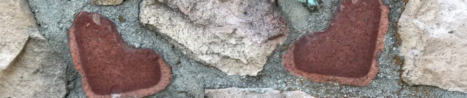
Historical Marker, definition: A historical marker is a permanent, publicly displayed plaque or sign (usually metal, stone, or wood) that commemorates, identifies, or interprets significant people, places, events, or sites. These markers are generally located near roads or on buildings for educational purposes, highlighting local, state, or national history.
Driving around the Carson City – Virginia City area, there are a number of markers commissioned by local state and fraternal entities.
These markers have two common elements tying them together. 1) the Wungnema Family built all of these markers; 2) all of the Nevada-based markers are in need of some serious TLC, a little love if you will. Stones are missing, mortar has dried and some of the brass plaques may need to be reset.
Perhaps, with the assistance of the State Historic Preservation Office (SHPO), funds could be raised and used to repair of these monuments. Surely, there are grants available for the preservation of historical markers. If not, the 2027 session of the Nevada Legislature will meet in February and it’s never too early to submit a budget request!
These markers celebrate people, places, events important to Nevada’s history. These markers say these people, places and events mattered enough to be remembered when there is no one left to speak of them first-hand. People die. Stories fade. Markers don’t.
These markers matter because they anchor memory in the physical world. They’re where meaning, history, and emotion receive permanent acknowledgement from people who cared. From people who cared enough to commission the finest stonemasons in the area to create lasting memories.
A historical marker says: this person/event/location mattered enough to be remembered when no one is left to speak about it.
Carson City – Nevada Historical Marker #1 Empire andthe Carson River Mills: This marker is located on U.S. 50 east of Carson City, this marker commemorates the site of the town of Empire and the mills that processed ore from the Comstock Lode.
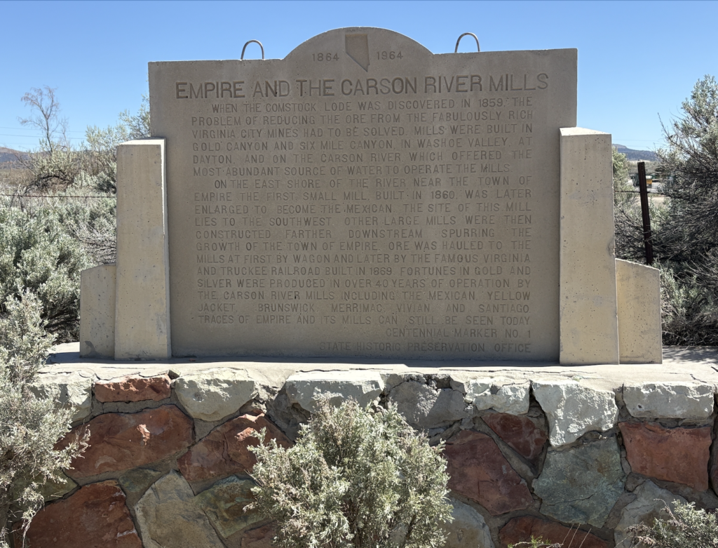
The marker was built by Randall Wungnema. If one doesn’t pay attention, one zips right on by it. It is in need of some serious TLC. True, refurbishing the marker will cost some money.
However, consider the history – This marker was created under the auspices of the SHPO in 1964, Nevada’s Centennial Year, and was the first marker commissioned by the SHPO. This marker initiated Nevada’s official historical marker program. As such, it deserves to preserved for future generations. Perhaps, that office could find some alternative funding sources to refurbish their initial historical marker. And, we know that there are descendants of Native American stonemasons who would undoubtedly be honored to work on this masterpiece created by one of their relatives.
Virginia City – The Comstock Lode Historic Marker: this markeris located in downtown Virginia City. It was commissioned in 1963 – 1964 by the Nevada Centennial Commission and built by Randall Wungnema and members of his immediate family.
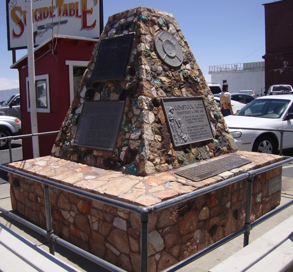
Randall’s original configuration showed the visionary nature of his work as the original top portion featured pipes 3” in diameter running west to east through the stonework. These pipes were designed to act as telescopes and allowed people a breathtaking view of Six Mile Canyon. Indeed, the wording on the marker’s comparative plaque appear to support Randall’s vision.
The text on the Comstock Lode marker reads approximately:
“Near this spot was the heart of the Comstock Lode, the fabulous 2½ mile deposit of high-grade ore that produced nearly $400,000,000 in silver and gold. After the discovery in 1859, Virginia City boomed for 20 years, helped bring Nevada into the Union in 1864 and helped build San Francisco.
Seven major mines operated during the boom. Their sites are today marked by large yellow dumps, several of which are visible from here — the Sierra Nevada a mile to your left, the Union, Ophir, Con Virginia, and, on the high hill to the southeast, the Combination. The Lode was worked from both ends, north up Gold Canyon and south from the Sierra Nevada and the Utah Mines.”
Erected by the Nevada Centennial Commission.
For reasons unknown to us, the top portion of the marker was removed and replaced with the current triangular configuration seen today. The original top sits in a gas station parking lot on the outskirts of Virginia City as one heads north out of town. The “telescopes” are still in place, though they no longer point to a view of any consequence
Louse Town – Louse Town Historic Marker: This markerwas erected in 1968 by the Julia C. Bulette Chapter No. 1864 of E Clampus Vitus as Nevada Historical Marker No. 41.
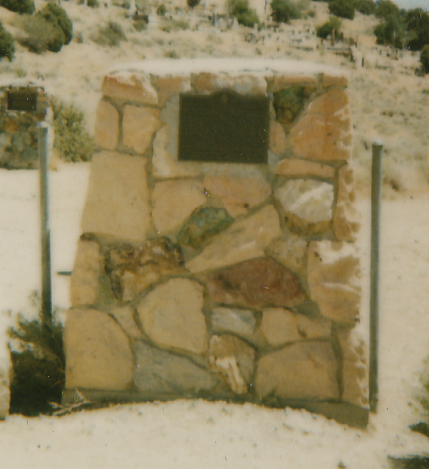
Again, members of the Wungnema Family were responsible for the construction of this marker.
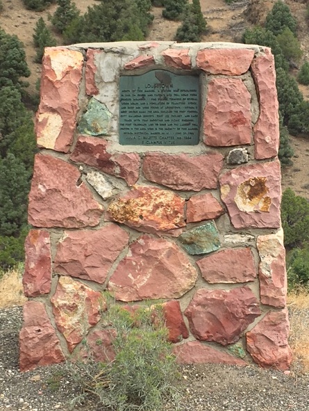
Here’s what we know about the marker: The site marked as Lousetown commemorates a once-active settlement and travel station from the mid-1800s, during the era of western migration and early Nevada settlement. It was located north of where the marker now stands, along an important wagon and toll road used by miners, sheepmen, teamsters, and others traveling between Truckee Meadows and the Comstock region near Virginia City. The area was noted for fine springs and was the terminus of several wood roads serving travelers and workers in the burgeoning frontier landscape.
It also had other historical “firsts” in that region, including being near early railroad surveys, the first ice project, and a local race track with trap shooting and picnic grounds — reflecting the lively character of frontier life at that time.
Today, the location is remembered primarily through a Nevada historical marker along Geiger Grade Road southeast of Virginia City.
The marker’s inscription reads (paraphrased):
“North of this marker, a station was established in 1860 on Geiger and Tilton’s new toll road from Truckee Meadows.
Fine springs, terminus of several wood roads, and a population of teamsters, stock and sheep men were found at Lousetown — Nevada’s most unique name.
The area included the first Virginia City railroad surveys, the first ice project, and a race track with trap shooting and picnic grounds. The first telegraph line to Reno and the largest toll station in the area were in the vicinity of this marker. “
Virginia City – Julia C. Bulette Marker: This marker was erected in 1963 by the Julia C. Bulette Chapter 1864 E Campus Vitus. As with many of the other historical markers in the area, this one was created by members of the Wungnema Family.
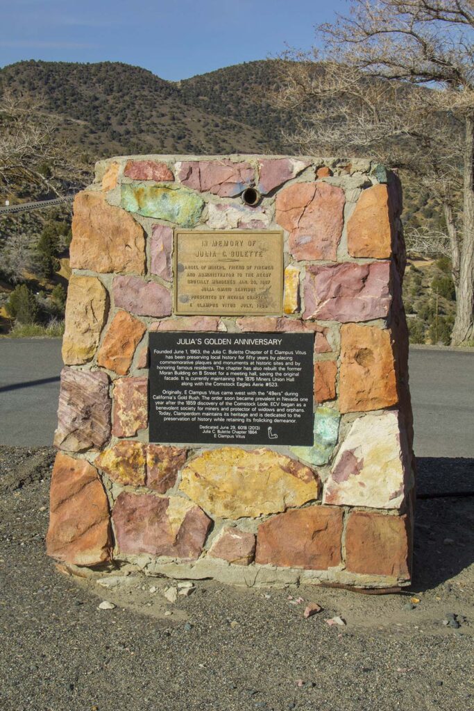
The marker is near the corner of an empty lot on the uphill side of D Street, just to the south of the steps that lead up to C Street. Note: this monument features a pipe running through it acting as a make shift telescope similar to the pipes inserted in the original top of the Comstock Lode Monument
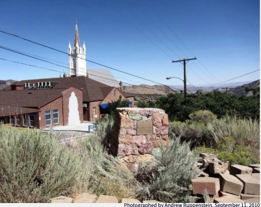
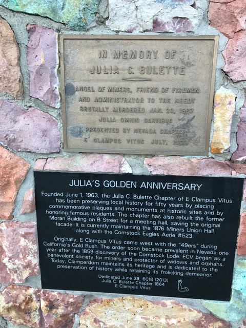
The inscription reads:
In Memory of
Julia C. Bulette
Angel of miners, friend of firemen
And administrator to the needy
Brutally murdered Jan. 20, 1867
Julia Omnio Services
Presented by the Nevada Chapter
E Clampus Vitus July 1963
Julia C. Bulette ( 1832 – 1867) was a prostitute and alleged madam in Virginia City Nevada. After her death, there were rumors and stories about her including one avowing that she was the proprietor of the most elegant and prosperous brothel in VC. Her life – real or imagined – has been the inspiration for movies and books.
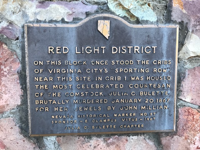
Virginia City – Red Light District Marker: This markerrecognizes the role of the red light district in the daily life of the booming mining town of Virginia City during the 1860s-1880s mining town and highlights an aspect of frontier life other than mining.
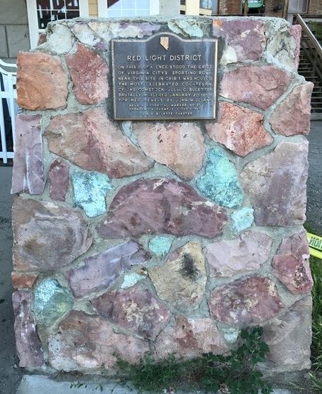
It was erected in 1967 by the the Julia C. Bulette Chapter 1864 E Campus Vitus and is Marker 37. As with many of the other historical markers in the area, this one was created by members of the Wungnema Family.
The inscription reads: On this block once stood the cribs of Virginia City’s “Sporting Row.” Near this site, in Crib 1 was housed the celebrated courtesan of the Comstock, Julia C. Bulette, brutally murdered January 20, 1867 for her jewels by John Millian,
Note the chipped upper corners of this monuments. Time – and possibly people – have not been kind to this beauty!
Virginia City – Johnstown Historical Marker: This marker commemorates Nevada’s first mining town which was established in 1853 and was located 2 miles southeast of Virginia City/Gold Hill in the Gold Canyon. It is often called Nevada’s first ghost town. The camp consisted of cabins and tents for the early prospectors who lived there prior to the 1859 silver discovery on the Comstock. The town was abandoned after that discovery. However, during its heyday, some of the residents were prominent citizens of the area.
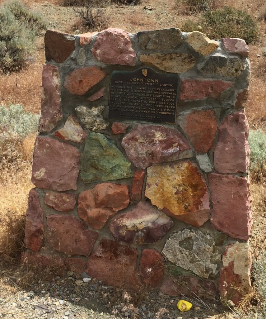
The inscription reads:
(Site one mile down Gold Canyon)
Nevada’s first mining town established in 1853. A boarding house was operated here by Eilley Orrum (Mrs. Sandy Bowers). Other prominent residents, discoverers of the fantastic Comstock Lode, included the Grosh Brothers, Peter O’Riley, Patrick McLaughlin, H.T.P. Comstock, and James Finney (Old Virginny).
Nevada Historical Marker No. 39
Sponsor – E Clampus Vitus – 1967
Again, this historical markers was created by members of the Wungnema Family.
Woodfords, CA – The Pony Express Remount Historical Marker: This marker is located in the historic (and cute) town of Woodfords, California.
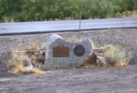
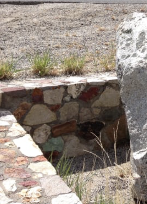
The marker was erected by the Historical Society of Alpine County.
The Wungnema Family believes the stonework around the marker is Randall Wungnema’s. Sadly, there are no documents (work orders, invoices, contracts, etc.) to support the family’s belief. However, the stonework strongly resembles other known examples of Randall’s workmanship.
Randall liked to include a piece of turquoise in each and every one of his projects – this was his signature. And guess what! There’s a piece of turquoise in the Woodfords’ stonework! So, until we learn otherwise, this will be included as the work of a Native American stonemason, namely Randall Wungnema.
A brief history of the Pony Express Remount Stations.
• In 1860, during the first weeks of the famous Pony Express mail service, Woodfords (then part of the Carson Route) served as an important remount station on the western end of the Pony Express line. Riders changed horses here as they carried mail between St. Joseph, Missouri and Sacramento, California.
• From April 4, 1860 to late April 1860, Pony Express riders stopped at Cary’s barn in Woodfords for fresh horses as they descended the eastern Sierra Nevada into the Carson Valley.
• After about five weeks, the Pony Express route was shifted to a different mountain pass, and Woodfords was no longer on the direct mail route.
• The site is recognized as California Historical Landmark No. 805 for its role in the Pony Express.
The plaque text (as recorded on the historical marker) reads approximately:
The Pony Express — Woodfords
During the initial five weeks of its operation in 1860, an important remount station of the famous Pony Express was located a few feet from here at Cary’s barn.
This marker erected by the Historical Society of Alpine County.
National Pony Express Centennial Association —
Dwight D. Eisenhower, Chairman;
Waddell R. Smith, President;
Sherrill Halbert, Director at Large.